


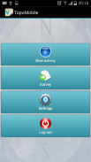

Topography APP
توضیحات Topography APP
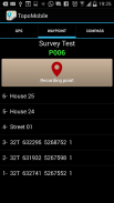
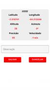
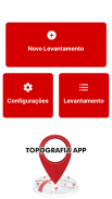
The Topography APP is an excellent application for georeferencing or land surveying, design of electrical networks, avenues, streets, subdivisions and studies in general.
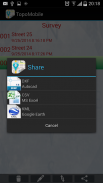
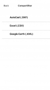
Export your surveys to DXF (Autocad), KML (Google Earth), CSV (MS Excel) without the slightest difficulty and the possibility of transmission by email of their withdrawals directly from the field to the office.
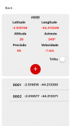
In the Professional version you can mark up to 5000 points for surveys.</div> <div jsname="WJz9Hc" style="display:none">De Topografie APP is een uitstekende applicatie voor georeferencing of landmeten, ontwerp van elektrische netwerken, wegen, straten, onderverdelingen en studies in het algemeen.
Uw enquêtes exporteren naar DXF (Autocad), KML (Google Earth), CSV (MS Excel), zonder de minste moeite en de mogelijkheid van overdracht van e-mail van hun opnames rechtstreeks van het veld naar het kantoor.
In de Professional versie u kunt maximaal 5000 punten te onderzoeken.</div> <div class="show-more-end">
Topography APP - نسخه 2.3.4
(16-05-2020)Topography APP - اطلاعات APK
نسخه APK: 2.3.4حزمة: aguiar.com.br.point_gpsآخرین نسخه Topography APP
سایر نسخهها


اپلیکیشنها در دسته مشابه
شاید دوست داشته باشید...
 2.293.323.724.174.57


